
The Lapita Voyage projectFrom the initial discovery of the Polynesians, their lifestyle and knowledge, which have enriched and lightened Western Society, have moved one way, from ‘them’ to ‘us’. It is time for us to give something back, this is what the Lapita Voyage is about. |
|||||||||||||||||||||||||||
The Tikopian and Anutan CanoesThe people of Tikopia and her sister island Anuta have built canoes of a very distinctive design for hundreds of years. This canoe design is probably the only Polynesian ocean going sailing hull design to have survived the total destruction of the Polynesian ocean voyaging culture. » [ more informations to download as a word document ] Pictures
|
|||||||||||||||||||||||||||
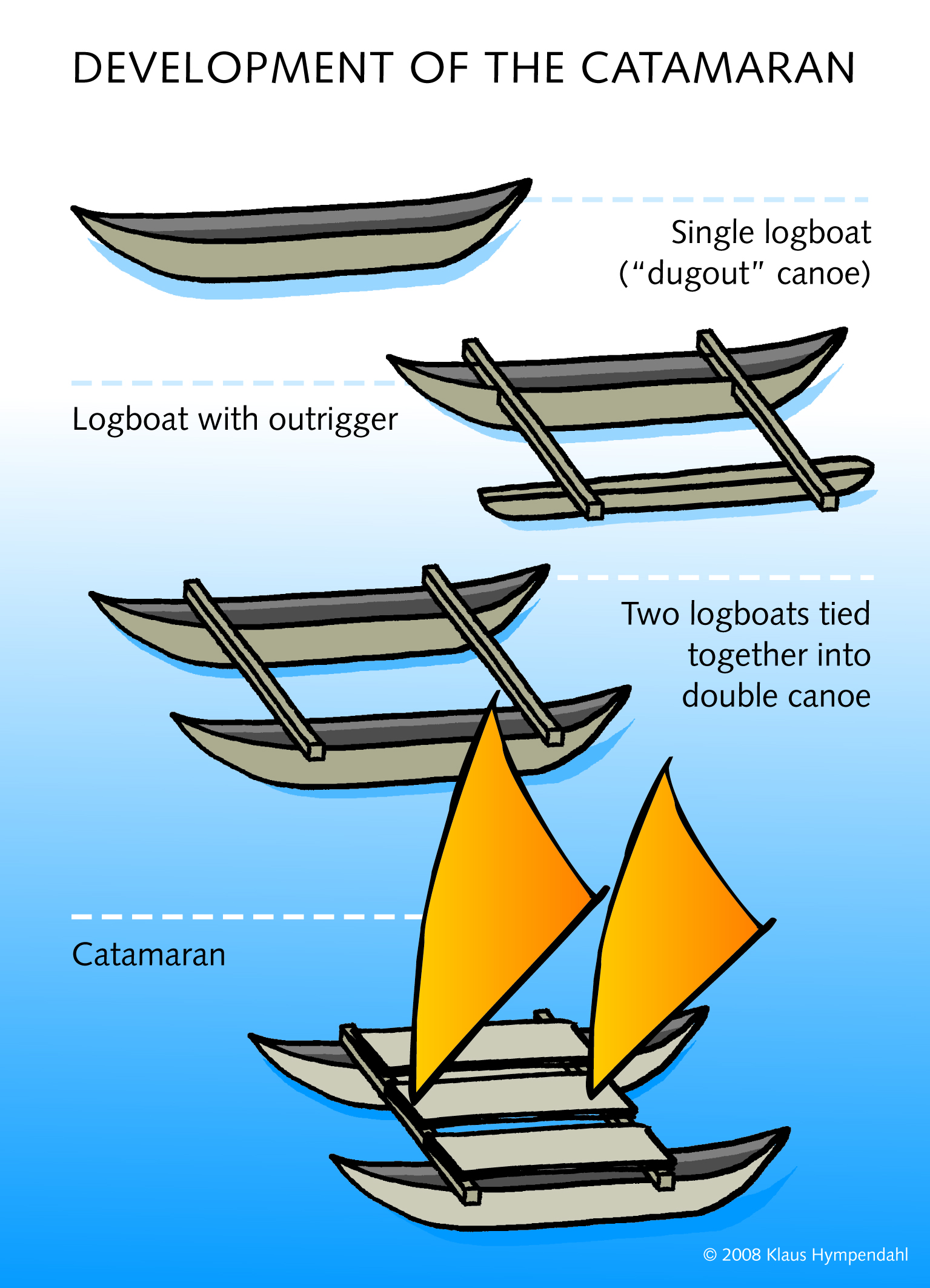
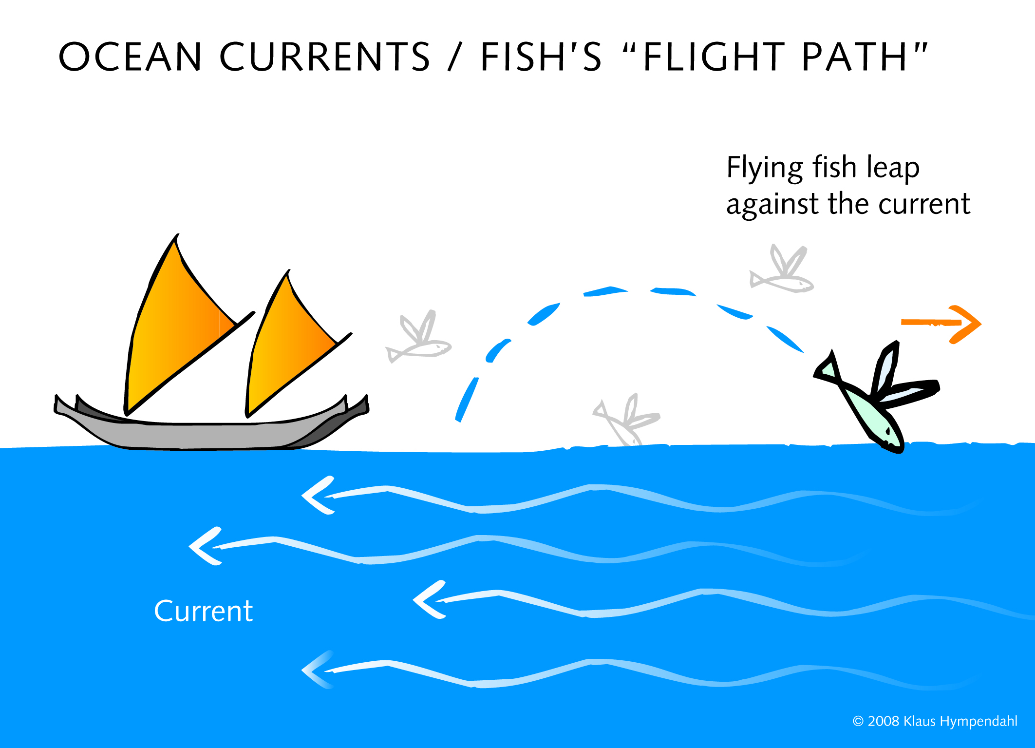
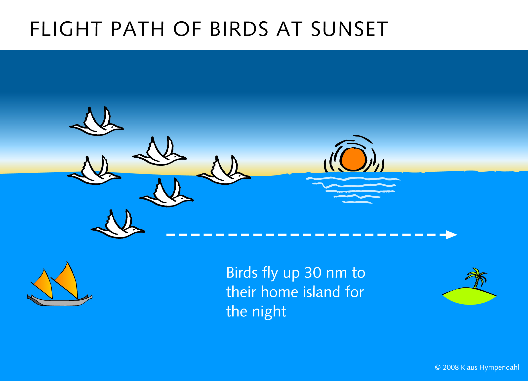
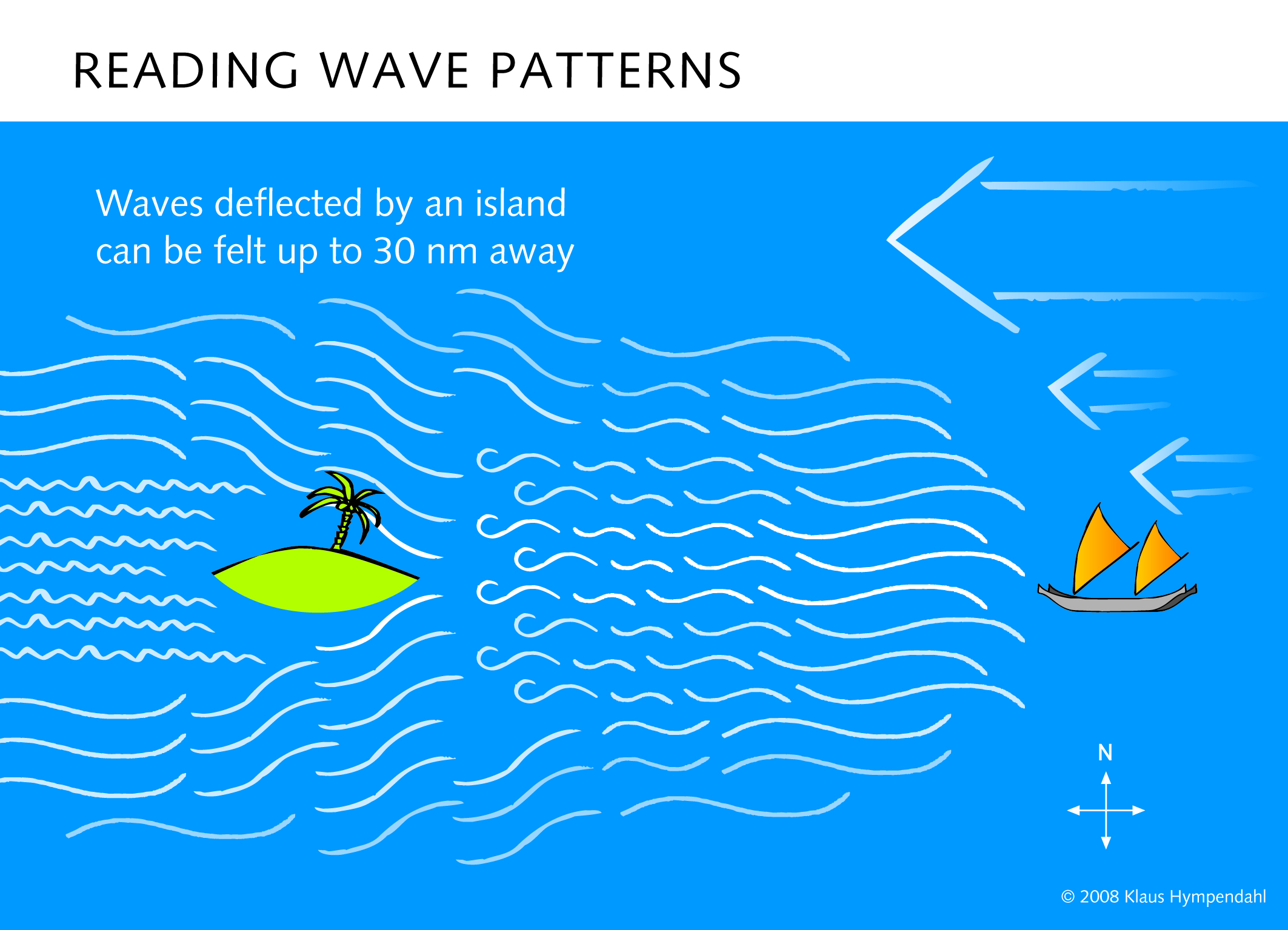
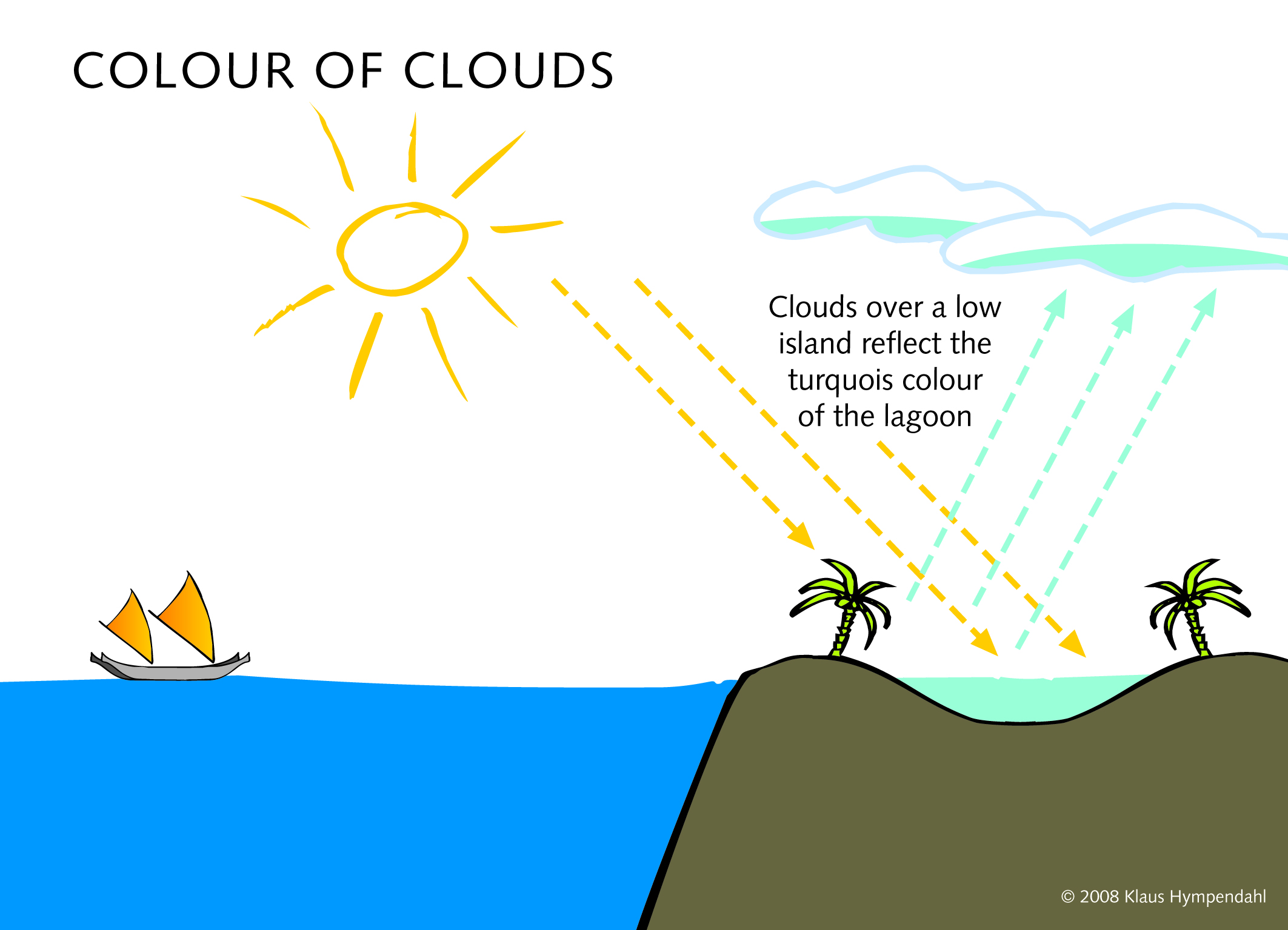
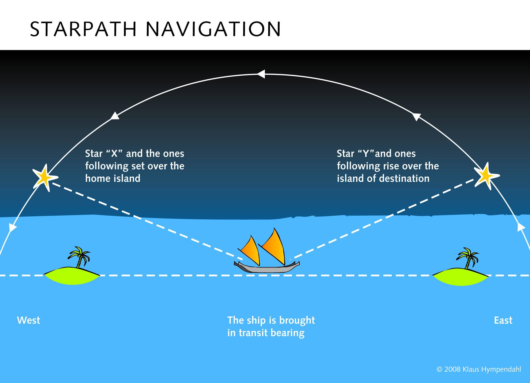
Pacific Navigation – in tune with natureAt the time of their migrations, the Pacific islanders had to navigate across hundreds, sometimes thousands miles of open ocean. This was only possible because they had two things, that no one for a long time believed they had: Seaworthy boats and the knowledge to navigate them over long distances – without the aid of Western navigational aids such as compass and sextant. The Pacific navigators relied instead on detailed knowledge and continuous observation of natural phenomena such as the stars, ocean currents, cloud formations and the behaviour of homing birds. » [ more informations to download as a word document ] Pictures
|
|||||||||||||||||||||||||||
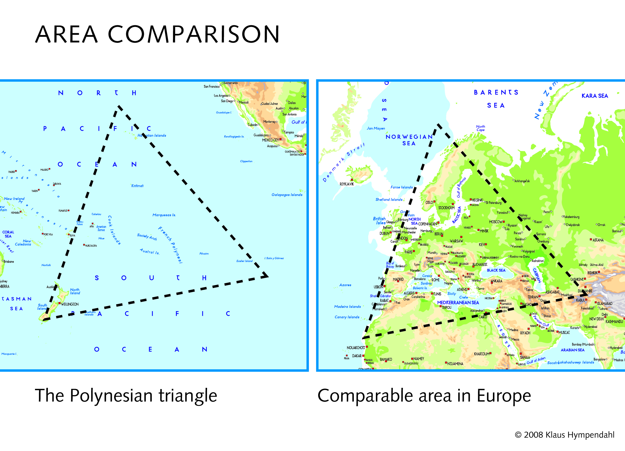
The Polynesian TriangleThe so-called ‘Polynesian triangle’ encloses the area of Pacific Ocean in which the Polynesian islands are situated. The North corner lies over the Hawaiian islands, the Eastern corner is at Easter Island and in the West its limit is New Zealand. With sides of the triangle of approx. 7000km (3900NM) it covers a very large section of the Pacific Ocean. The enormous size of this area has raised the question: How did the Polynesians (2000 to 800 years ago) manage to sail these seemingly infinite distances between the far distant island groups? Factually no other single Stone Age Culture, before or after, has ever achieved such a wide expansion over such a large area of ocean. |
|||||||||||||||||||||||||||
The Polynesian EnigmaWestern people often do not realise, that 70% of our planet is covered by Ocean. Half of this sea area is the Pacific Ocean. When European explorers, in the mid 18th Century, began to explore this part of the world, they found small islands and archipelagos scattered across the vast ocean, and on these islands were people, people that seemed to be speaking a similar language and had similar customs, whose ancestors had arrived - from where? |
|||||||||||||||||||||||||||
Tikopia and AnutaTikopia is a tiny tropical island of just 1.8 square miles situated in the SW Pacific, at the Eastern end of the Solomon - Santa Cruz islands, supporting a population of approx. 1200 people of Polynesian descent. This island has been self supporting/self sufficient for the last 3000 years using stone age technology. The nearest island (85 miles distant) is the even tinier sister island of Anuta (population 250). Other slightly larger islands in Vanuatu and the Solomons are between 100 and 140 miles distant. |
|||||||||||||||||||||||||||
Cyclone Zoe and its aftermathIn late 2002, the Solomon Islands, which include Tikopia and Anuta were devastated by a tropical cyclone. The centre of the cyclone passed directly over Tikopia and Anuta, where it destroyed many of the houses and gardens as well as almost the entire vegetation. With wind speeds of over 300 km/h (165 knots), Zoé was a category 5 storm and the strongest ever recorded tropical cyclone. |
|||||||||||||||||||||||||||
Lapita Voyage – a unique oppurtunity for researchIn 1948 Thor Heyerdahl, because of lack of other proof, advanced the theory that the Polynesians came from South America. Today, as a result of advances in the sciences of genetics, linguistics, archaeology etc., it is agreed that the ancestors of the Polynesians originated in SE Asia. |
Copyright © 2009 Klaus Hympendahl. All rights reserved.